
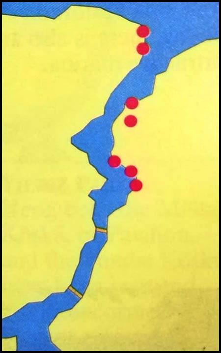
The only way to explore the Bosphorus beyond the last ferry stop is by boat, for the shore roads do not extend much farther beyond the last two villages. An excursion by boat along the upper Bosphorus can be exhilarating, for both shores are wild, rugged, desolate and quite beautiful. At several places there are sandy beaches hidden away in secluded coves. Gray herons 18 haunt the cliffs, black cormorants dive into the limpid water, flights of shearwaters, kirlangiç in Turkish, skim along the surface in mid-channel, and schools of dolphins can occasionally be seen in the strait, which is considered a good omen by sailors.
Three nautical miles beyond Rumeli Kavağı we pass a very craggy promontory on the European shore named Garipçe, meaning “strange,” or “curious,” probably because of its very contorted features. The Blue Rocks were also called Cyanean, or the Symplegades, and Gillius identified them as a striking feature at the mouth of the Bosphorus on the European side, 100 yards offshore at Rumeli Feneri.
Called the “Lighthouse of Europe,” this huge rock still has the remains of a fort built in 1769 by a Greek military engineer in the Ottoman army. There was a similar fortress on the Asian side – a Byzantine toll station known as the “Lighthouse of Asia” – but this has not survived, probably worn away by the pounding I waves of the Black Sea, which the Greeks called “Hospitable” only to placate it.
Here, both the Malta Köşkü, or Pavilion, and the Pembe Köşkü have been restored and transformed into elegant cafés.
Travelling down the Asian shore of the Bosphorus you will come to the most prominent monument of the upper Bosphorus, a great fortress whose ruins are on the heights north of Anadolu Kavağı, a name which
means “poplars of Anatolia.” This fortified site is also commonly known as the “Genoese Castle,” even though it was probably built by the Byzantines as a toll gate and merely taken over by the city-state of Genoa in the 14th century. The loss of revenue from the collection of tolls, on both sides of the strait, may well have been a contributing factor in the decline of the Byzantine Empire. The fortress encloses an area twice as great as that of Rumeli Hisarı, and though mainly a ruin, it is still impressive. It is from here that the ferry begins its return journey back down the Bosphorus.
Opposite Sariyer we pass the Yuşa Tepesi – Hill of Joshua – the second highest peak on the Bosphorus, reaching a height of 660 feet above sea level. On the summit is a shrine to a Muslim saint named Yuşa Baba, whose grave, marked by green pillars at the head and feet, is 40 feet long. His tomb, which Europeans call the “Giant’s Grave,” was known in antiquity as the “Bed of Hercules.”
THE CHANNEL, ALONG ITS ENTIRE LENGTH… LOOKS THE SAME AT EVERY POINT; IT IS BORDERED BY PALACES, KIOSKS, COUNTRY HOUSES, AND VILLAGES. CASTELLAN
Opposite Büyükdere is a long shallow bay with a rugged and forbidding shoreline. At Selvi Burnu – “Poplar Point”- the coast turns east to the valley of Tokat Deresi. It was here Fatih built a villa, as did Süleyman. Gillius described the place as a “royal villa shaded by woods of various trees, especially planes,” before going on to mention the landing stairs, “by which the King, crossing the shallow shore of the sea, disembarks into his gardens,” hence the modern name of the site, Hünkar Iskelesi, or the “Emperor’s Landing Place.” The present little palace 84 was built in the mid-19th century for Abdül Mecit by Sarkis Balyan, a brother of Nikoğos Balyan. It is still shaded by a lovely grove of plane trees, but it is now used as a hospital.
During the summer, the wooded hillsides. of the Bosphorus were beautifully fresh and cool. They became a favorite.
The ferry stops at Beykoz, the largest fishing village on the Asian shore of the Bosphorus above Üsküdar. At weekends during the summer its seafood restaurants and small cafés are packed with visitors from the city. The principal monument in Beykoz is a beautiful street fountain 66 in the village square. Ishak Ağa, a customs inspector, had it designed and installed in 1746.
A road leads from Beykoz to the picturesque village of Şile on the Black Sea, where there is a splendid sandy beach, with hotels and restaurants. Since antiquity the women of this village have woven a particularly light and silken cotton called şile bezi. Much of the cloth is exported. The French-built lighthouse just east of the village is now a registered historic monument. The Kumbaba Motel, which is on the beach east of Şile, occupies the site of ancient Calpe, a number of ruins of which have been uncovered by archeologists. South of Beykoz at Incir Koyu, or “Figtree Village,” is the charming valley of Sultaniye Deresi, where Beyazıt II had
extensive gardens laid out.
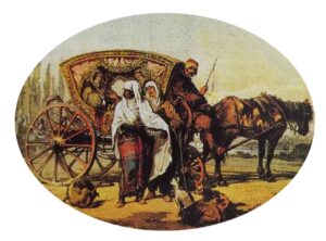
A little farther on is Paşabahce – the Paşa’s resort for young women, who arrived from the city in carriages. For their picnics, they wore light yaşmaks and muslin veils, showing only their eyes.
Garden 50-so called because of the palace and garden established here by Hezarpara Ahmet Paşa, who was grand vizier under Murat IV. Its renowned produce the finest glass works
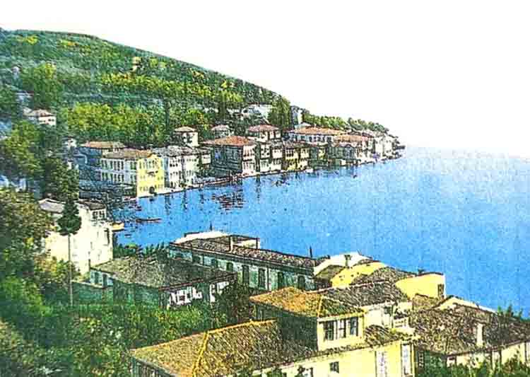
Beykoz is an important village in the former Bay of Amycos. In this view we can see the beautiful yahı of Mehmet Ali Paşa, viceroy of Egypt. The valley beyond Beykoz is one of the most beautiful on the Bosphorus.